
Bloomingdale Previous Resident Eras
No single roll lists every person who occupied a Bloomingdale address. Each source covers an era and a specific relationship to the property. Start with the source nearest the target date, then use another record type to confirm the result.
| Source | Years It Covers | Where Held | What It Shows |
|---|---|---|---|
| Recorder online name and image index | March 16, 1961-present | DuPage Recorder web and office | Parties, instrument, date, and property details |
| Recorder office property records | 1839-present | Recorder Research / public terminals | Earlier deed books and indexes |
| BPL maps and house-numbering map | 1870-present; key map in 1963 | BPL Local History Room | Street, plat, zoning, and address continuity |
| BPL real-estate listings | Early 1960s-early 1980s | BPL Local History Room | Name, address, and listing clues |
| Haines criss-cross directories | 1988-2021 and 2004-2021 | Wheaton Public Library | Listed occupant or business by address |
| Telephone books | 1951-2016; suburban film 1920-1971 | Wheaton Public Library | Listed subscribers and businesses |
| County directories and census | Verified directory years 1915-16 and 1925-26; census holdings vary | Wheaton Library / digital archives | Names, households, occupations, and dated residence |
For a recent transfer, use the parcel card and Recorder. For a late-twentieth-century occupant, test Haines and phone books. Older Bloomingdale previous residents require county directories, census schedules, maps, and local files. A blank row only marks the limit of that source.
Start With Bloomingdale's Parcel
The DuPage Property Lookup accepts a PIN, street address, billing name, or map route. Open the parcel card and save the ten-digit PIN, property or situs address, billing name and address, legal description, and any transfer or conveyance detail. Situs means the physical property location. The billing address is where tax mail goes, and it can be somewhere else.
A parcel card may also expose assessed value, tax history, exemptions, split or combine history, map links, and a tax-year selector. Those fields describe land and taxation. They do not prove that the billing name lived at the site. Still, the PIN and legal description are the best keys for following a Bloomingdale address through changed street labels, trusts, estates, and subdivision records.
Read the transfer and conveyance tabs as leads, then carry the displayed instrument detail to the Recorder. A homestead exemption may show that an owner claimed the parcel as a primary residence for tax purposes, but it is not proof of present occupancy. Its absence proves nothing about who lived there. Tax status, redemption, and special-assessment fields also describe the parcel, not its household. Save the tax year with every copied value because the portal can display different years. A screenshot or dated note prevents a later update from being mistaken for the state of the record when the search began.
Save both addresses. DuPage stores property and billing address fields separately; label each one before tracing past residents.
Trace DuPage's Bloomingdale Deed Chain
The DuPage Recorder search can take a party name, street information, PIN, document number, document group or type, and date range. A grantee is the party receiving an interest. A grantor gives or transfers it. Walking backward means finding the current owner's acquisition, then searching the seller in the receiving role for the seller's earlier acquisition.
- Copy the current PIN and legal description from Property Lookup. Keep the situs and billing addresses separate.
- Find the current acquisition instrument. Open the document detail and note its number, date, parties, type, and property match.
- Take the seller or grantor from that deed and search that person as a prior grantee.
- Repeat the handoff. Use the same legal description or PIN to avoid attaching an unrelated same-name deed.
- When the web index stops, contact Recorder Research for older books, public-terminal help, or a certified copy.
- Grantor / grantee
- The giver and receiver of the property interest shown by an instrument.
- Chain of title
- The linked sequence of recorded transfers for the same land.
- Legal description
- The formal land description tied to lot, block, subdivision, or survey terms, which can outlast a street number.
The Recorder's documented result fields include document number, indexed parties and roles, document type, recording or effective date, property match, document detail, and a View/Print PDF route. No live Bloomingdale deed row was captured in the research, so do not guess an instrument number.
Bloomingdale's 1961 Record Divide
The Recorder's web index and images begin March 16, 1961. That date is a digital boundary, not the first day of Bloomingdale land ownership. Official instructions say office property searches reach 1839 to the present, while computer searches vary by key: name from 1961, PIN from 1985, and property address from 1995. Plats reach into the 1800s.
The Recorder home page states the online and office access distinction.
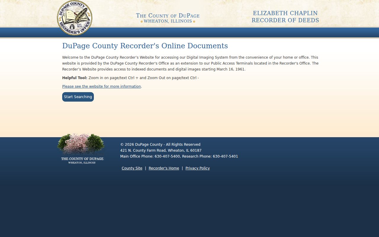
The screen capture marks the point where a web search can go dark even though older records remain at the office. Recorder Research is at 421 N County Farm Road in Wheaton, with a research line at 630-407-5401. Ask about public terminals, older indexes, and certified copies.
Bloomingdale Plats Preserve Place
A deed chain may pass through a subdivision, resubdivision, consolidation, annexation, disconnection, trust, or estate. Search the Recorder's document-type controls for the matching instrument, then compare the legal description. Village ordinances and hearing packets can identify the municipal action, while the recorded plat fixes the land.
This matters at sites such as the former Stratford Square Mall, now addressed in Village records as The Grove at Bloomingdale. The 2025 and 2026 record trail includes TIF material, acquisition actions, public hearings, and a plat of consolidation. Saving the present PIN, plat, ordinance number, and page date now will make a later previous-resident or site-history search far less ambiguous.
The Village Archive Center is the practical municipal route. Its controls include category, keyword, archive, time period, and start and end dates. Search an address, PIN, subdivision, owner name, or project term, then request the underlying packet when the archive description is too brief. Building and zoning forms can identify which type of file may exist, but no public address-keyed permit or code-case database was located. Requests for those records go through the Village's general public-record route. Fire records belong to the separate Bloomingdale Fire Protection District, so one request cannot cover every custodian.
Note: Municipal borders and postal labels may move while the parcel's legal description still ties the records together.
Map Bloomingdale Address Changes
The BPL map collection covers 1870 to the present and includes a 1963 Village of Bloomingdale House Numbering System map. It sits among dated street, plat, township, zoning, topographic, and house-number maps. Use the map closest to the target year, then compare cross streets, lot lines, subdivision names, and any old postal-city label.
Open the library's map inventory to choose the right year.
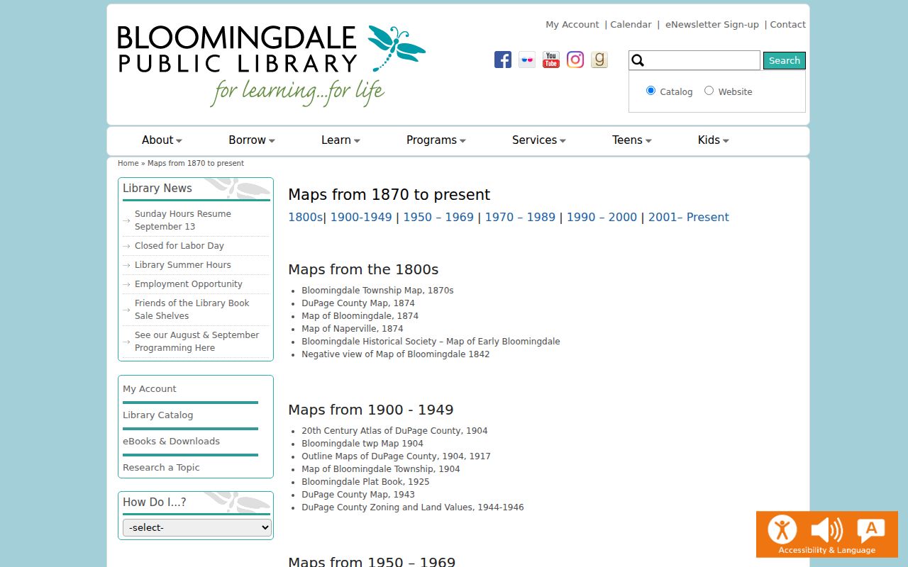
The collection supplies a concrete bridge across the 1960s development era. It does not identify one blanket renumbering ordinance, so treat the 1963 item as a dated reference and verify each address separately.
Bloomingdale Past Household Evidence
Owners are only one part of the story. Haines criss-cross directories can turn an address into a listed occupant or business for 1988 through 2021 and, in another series, 2004 through 2021. Wheaton telephone books cover 1951 through 2016, with suburban microfilm for many places from 1920 through 1971. The source details belong to the Bloomingdale city directory collections, while the task here is to connect each listed household to one address over time.
For earlier years, pair a county directory with the nearest available census schedule. Keep the dates distinct. A directory is a publisher's listing, while a census records a household at its enumeration date. Wheaton documents DuPage print census holdings for 1840 through 1870, microfilm for 1860 through 1880, 1910, and 1930, plus the 1865 Illinois State Census.
- Use a dated map to establish the address form used in that era.
- Check the closest reverse directory, phone book, or surname directory.
- Compare the nearest census schedule and record every household member shown.
- Test a disappearance with an obituary, cemetery entry, probate file, newspaper, or later directory.
Lawful use. Research Bloomingdale previous residents for family or house history. Never use personal details to track, threaten, or harass a living person.
Bloomingdale Obituaries Close Gaps
The BPL Obituary Index can explain why a household name stops appearing. Entries are alphabetical, and some link to PDF notices. If no PDF is attached, BPL invites requests at 630-924-2765 or bdlh@mybpl.org. The cemetery index and local newspaper titles add other routes.
Search the library obituary index by the confirmed surname.
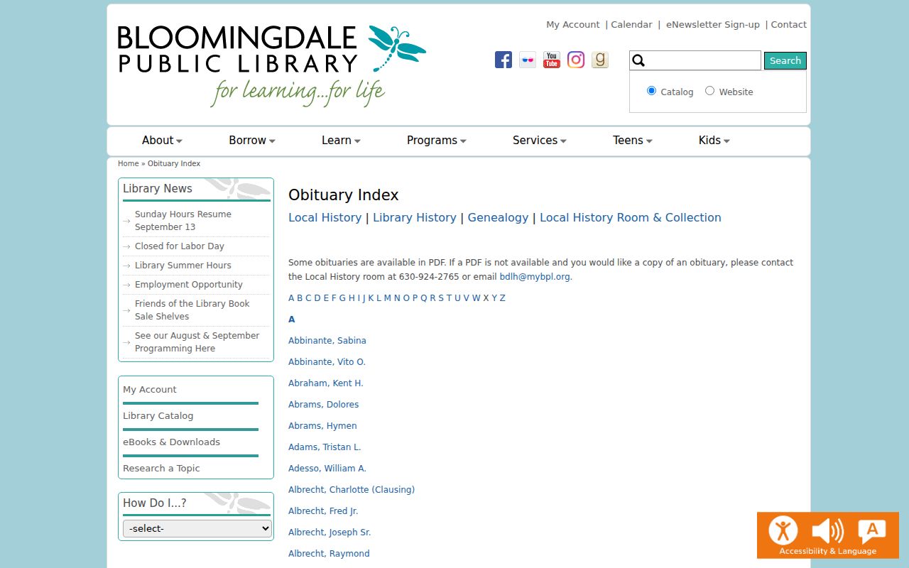
An index hit is a lead, not proof that the person occupied the property. Confirm the newspaper image, address, relatives, probate file, or recorded estate instrument before closing the trail.
When Bloomingdale Records Go Dark
Use the fallback chain when the web trail fails: Recorder Research for pre-digital deeds, BPL staff for maps and missing obituary scans, Wheaton Library for directories and census, and the DuPage Historical Museum for maps, plat books, real-estate files, newspapers, and vertical files. The museum offers on-site work by appointment and limited paid staff research.
The Bumstead OCR offers another name-search route for the 1915-16 volume.
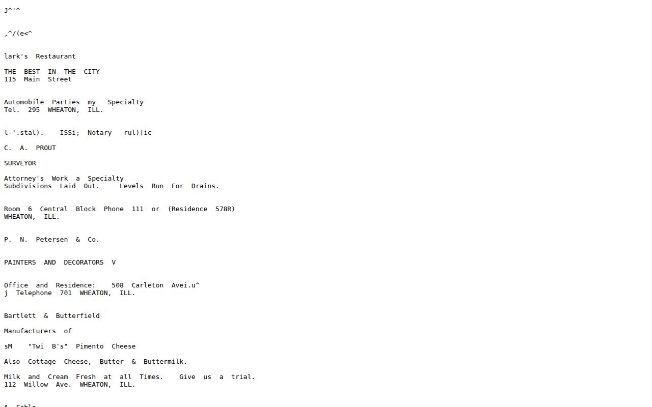
Compare every OCR match with the scanned page. Old type can corrupt surnames, initials, and trades. Honest gaps remain: no verified Bloomingdale, Illinois, Sanborn map was found, and the similarly named Library of Congress result belongs to Indiana.
When asking BPL for help, give the address as it appeared in the target era, the modern address if known, and the closest confirmed surname. Staff can check the historic-building index, early-1960s through early-1980s real-estate listings, maps, cemetery index, and local newspaper material. Wheaton's Genealogy and Local History Specialist can help with the wider county directory, census, phone-book, and Haines shelf. The museum route is strongest when a question calls for vertical files, real-estate records from the 1950s through the 1970s, personal papers, maps, or plat books.
Keep a short search log. Note the exact portal field, name form, date range, PIN, and result, including a clear “no result.” A later search by legal description may succeed where an address search failed, especially before the Recorder's 1995 address-search boundary. The same log stops an OCR miss or absent telephone listing from being misread as proof that nobody lived at the property.