
Walk a Bloomingdale Street
A sound Bloomingdale street directory search works from the ground up. Start with one valid address, resolve it to a DuPage parcel identification number, or PIN, and use the map to move to the next lot. The county tax card identifies the situs address, meaning the place where the parcel sits, as well as the billing name and mailing address. Those fields may point to the same place, but they do not have to. The rest of the chain tests the owner name against recorded transfers, voter address tools, and older address sources.
- Enter a full address in DuPage Property Lookup. Save the PIN, situs address, billing name, and legal description.
- Open the parcel in the GIS Parcel Viewer. Zoom close enough to see lot lines, then select nearby parcels in order.
- Carry each PIN back to Property Lookup. Record ownership without treating the billing name as a household list.
- Search the Recorder by party, PIN, street, document type, and date. Follow each deed from grantee back to grantor.
- Use the voter address form for precinct context. For older occupants, consult criss-cross directories and dated maps.
Write down the spelling used by each system and its date. A PIN is more stable than a postal label after a subdivision, annexation, or plat change. When the goal changes from a street to one named person, continue with the Bloomingdale resident lookup.
Do not skip the result date. Assessment data reflects a certified tax cycle, deed data reflects a recording date, and a directory reflects its publication year. Someone named in one source may have sold, moved, or used a separate mailing address by the time another source was made. The best Bloomingdale street directory result is therefore a short evidence log: address as entered, matched PIN, source title, date viewed, field label, and any mismatch. That log also makes later corrections much easier.
Bloomingdale Street Lookup Fields
DuPage Property Lookup offers parcel number, address, billing name, and map routes. Its data comes from the last certified assessment, can change, and may not be mined in bulk. Result cards can include assessment, exemptions, transfer history, legal description, tax status, and map links. The portal is the main current starting point for a Bloomingdale street directory search.
| Field | Input | Use by street |
|---|---|---|
| PIN | Ten-digit parcel number | Stable county and deed key |
| Address | Current street address | Starts a by-address search |
| Billing Name | Owner or billing name | Finds a card when an address fails |
| Map Search | Geographic interface | Moves between nearby parcels |
| Tax Year | Result selector | Checks another assessment year |
The county sample parcel card shows how these fields connect.
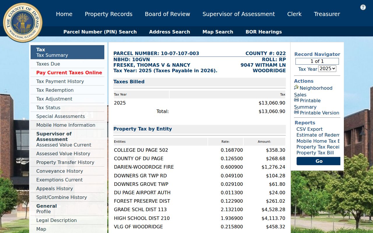
The card keeps the owner display, situs, PIN, tax year, transfers, and map controls distinct. Each is evidence with a different meaning.
A result card also exposes routes for assessed-value history, exemptions, appeals, split or combine history, tax payment, redemption, neighborhood sales, and conveyance history when those tabs hold data. Use only the label actually shown. Tax due, an appeal, or a transfer entry can lead to another record, but none identifies all Bloomingdale residents at the parcel. If an address search misses, try the billing name or map route, then compare the legal description before accepting the match.
Bloomingdale Street Address Types
Save both `PROPADDR`, the property or situs address, and `BILLADDR`, the address assembled for tax billing. The first locates the land. The second tells where the county sends the bill. An owner may receive mail elsewhere, and a person at the situs may not own the parcel. This distinction is a useful check in every search by address.
- Parcel
- A mapped unit of land with its own county PIN.
- Situs address
- The street address assigned to the physical parcel.
- Plat
- A recorded map laying out lots, streets, or a subdivision.
- Criss-cross directory
- A directory arranged by address or phone rather than surname alone.
Compare both addresses with the legal description before deciding that records concern the same place. A homestead exemption can support an owner-occupancy inference, but it does not prove who is present now.
Browse Bloomingdale Street Parcels
The DuPage GIS Parcel Viewer accepts a PIN or property address. Advanced Search can use partial street details. Selecting a result zooms to the parcel; results can be downloaded as TXT, CSV, PDF, XLS, or XLSX, and ReportToPDF makes a map report. Shape and buffer work is capped at 1,000 parcels. A documented multi-PIN URL can carry up to 100.
The Buffer tool begins at 250 feet and can select from parcel results or map-popup features. It highlights touching or nearby lots. Carry each PIN to its property card rather than reading map color as proof of a household.
Bloomingdale's map catalog adds address, subdivision, zoning, land-use, utility, and floodplain maps.
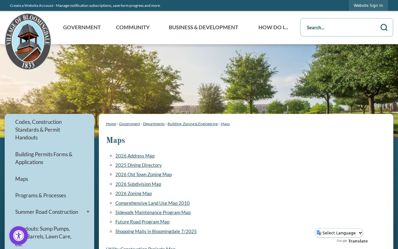
The municipal maps can explain a boundary or planning label that the county parcel image alone does not show.
GIS also offers point and polygon shapes, subdivision search, Pictometry, measurement, street intersections, map layers, and item details. Parcels can vanish when the view is zoomed too far out and return when it moves closer. That display behavior matters when walking a long Bloomingdale road. Save the result list rather than relying on one screen image, then check each parcel against the current county card.
Bloomingdale Streets in Deed Records
The DuPage Recorder index accepts street number, direction, street, city, PIN, party names, document number, type, and date range. Online indexed documents and images begin March 16, 1961. Computer searches start in 1961 by name, 1985 by PIN, and 1995 by address. Office property research reaches 1839.
Grantor means the party transferring an interest; grantee means the party receiving it. Search the current owner as grantee, open the detail, save the instrument number, date, parties, and legal description, then search the prior grantor. Trusts, estates, and companies can make the chain branch. A blank early result calls for a name, legal description, book and page, or Recorder Research at 630-407-5401.
Note: A blank web result may mark an index boundary, spelling issue, or legal-description change, not the absence of a recorded owner.
Bloomingdale Records Found by Street
No single roll is a complete street directory. These sources overlap, and each has a different custodian and time span.
| Record Set | Keeper | What It Shows | Access |
|---|---|---|---|
| Property card | DuPage Supervisor of Assessments | PIN, billing name, situs, transfers, legal description | Free portal |
| GIS parcel map | DuPage GIS | Geometry, subdivision, nearby PINs | Free viewer |
| Recorded instruments | DuPage Recorder | Parties, deeds, plats, liens, dates | Web from 1961; older office research |
| Voter address search | DuPage Election Division | Polling place, precinct, districts | Free public form |
| Permit or code file | Bloomingdale Building & Zoning | Applications, approvals, inspections if retained | Form or records request |
The PIN ties map, assessment, and deed sources together. Street spelling links current addresses to election and Village files. For older work, the legal description, dated map, and directory year can be stronger than today's house number.
Access is also split between web and counter. The free Recorder index is only one channel; older books, public terminals, research help, and certified copies remain with the Recorder at 421 N County Farm Road in Wheaton. Library map and directory material may require an on-site visit or staff request. Village permits without a public index require a form or Illinois FOIA request. A strong Bloomingdale street directory keeps these fallback routes visible when a portal ends.
Bloomingdale Street Election Records
The DuPage voter and address search has voter, address, and district routes. Its address route uses house number, street, and city, with direction and suffix handled separately. Search tips say to omit direction and suffix from the street-name field. The result is useful for polling, precinct, and district context, not for listing all voters on a block.
Illinois Election Code limits voter-file use and redacts sensitive fields. Protected voters receive added confidentiality. Use the public form narrowly, and ask the Election Division for lawful aggregate data instead of trying to reconstruct a household list.
Request Bloomingdale Street Records
Bloomingdale permit pages provide forms and review routes, but research found no public address-search database. A retained file may name an applicant, contractor, parcel, plans, approvals, and inspection correspondence. Ask Building & Zoning for a specific address and date range.
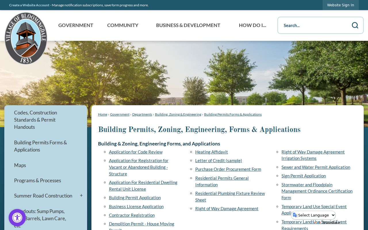
The captured forms show why the fallback is a focused request, not a guessed portal search.
The Village Archive Center searches ordinances, reports, notices, packets, and newsletters.
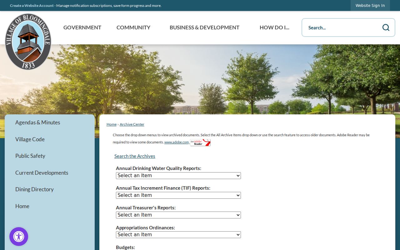
Address-specific ordinances, annexations, and plats can explain a new municipal label. Unposted material may be requested under Illinois FOIA; police, general Village, and fire files have distinct routes.
Bloomingdale's 1963 Street Records
Bloomingdale Public Library holds a Village House Numbering System map dated 1963, plus 1958 streets, 1959 plats, 1961 telephone-plan and topographic material, 1965 township maps, and later house-number and zoning maps. No official source gave the exact renumbering ordinance or a list of all changed streets. Treat 1963 as a research bridge, not proof of one sweeping change.
Compare a modern street with BPL's dated maps, then check Haines criss-cross directories at Wheaton Public Library. The documented runs cover 1988-2021 and 2004-2021 series. BPL's real-estate listings span the early 1960s through early 1980s. Full shelf detail belongs in the Bloomingdale city directory.
New Bloomingdale Streets at The Grove
The former Stratford Square Mall site is becoming The Grove at Bloomingdale. Village files from 2025 and 2026 include TIF material, acquisition action, public hearings, and a plat of consolidation. Future lots should be traced by PIN, legal description, ordinance number, plat, and document date, not by a venue name alone.
The Village project page preserves the municipal side of the change. Recorder plats and county parcel cards carry the land side. This timely layer shows why a Bloomingdale street directory must retain source dates.
Annexation and planning records pose the same issue elsewhere. Bloomingdale actions in 1983, 2022, 2025, and 2026 show that a municipal label can shift while the county parcel persists. Search the Village archive by ordinance or PIN, then compare the recorded plat. Postal city, township, Village, subdivision, and legal tract may all describe the same land in different record eras.
Limits of Bloomingdale Street Records
A parcel card identifies land, tax fields, and a billing name. It does not list every occupant, child, guest, or person who receives mail there. GIS proximity is not proof of a tie. The voter address route is not an all-voter export. Driver address data is restricted by federal law, utility customer files are not public, and Illinois shields Social Security numbers and some confidential addresses.
Illinois's Address Confidentiality Program gives eligible participants a substitute address in new government records. The Attorney General warns that real-property records cannot always be shielded and old public records are not erased. Do not try to reverse a substitute address through another source.
Lawful use. Bloomingdale address records support family history, property research, civic review, and scam checks. Never use them to watch, harass, threaten, or harm a person.