
Bloomingdale ZIP Rows Verified
Official sources support two Bloomingdale postal rows, but they do not mean the same thing. The Illinois Commerce Commission's filed DuPage list includes 60108 and 60117. USPS supplies the address-level answer. The ordinary local row is 60108. Historical Postal Bulletin entries connect 60117 with Great Lakes Area postal or facilities-service addresses in Bloomingdale, so that row belongs in the ZIP code directory as dated operational evidence, not as a blanket residential zone.
| ZIP Code | Areas Covered | Post Office | Notes |
|---|---|---|---|
| 60108 | Ordinary Bloomingdale delivery addresses | Bloomingdale Post Office, 108 W Schick Road | Verify each street and unit with USPS |
| 60117 | Dated operational or unique-use evidence | No separate current local station found | Historic federal examples; not a generic residential shortcut |
Do not add nearby ZIPs because a map looks close. No official neighborhood-by-neighborhood split or current address crosswalk was located. A full street address, including apartment or suite, should go through USPS. The result confirms delivery formatting, not who lives or works there. Parcel and resident questions require separate county sources.
Check the official Bloomingdale Post Office listing before using its captured facility page.
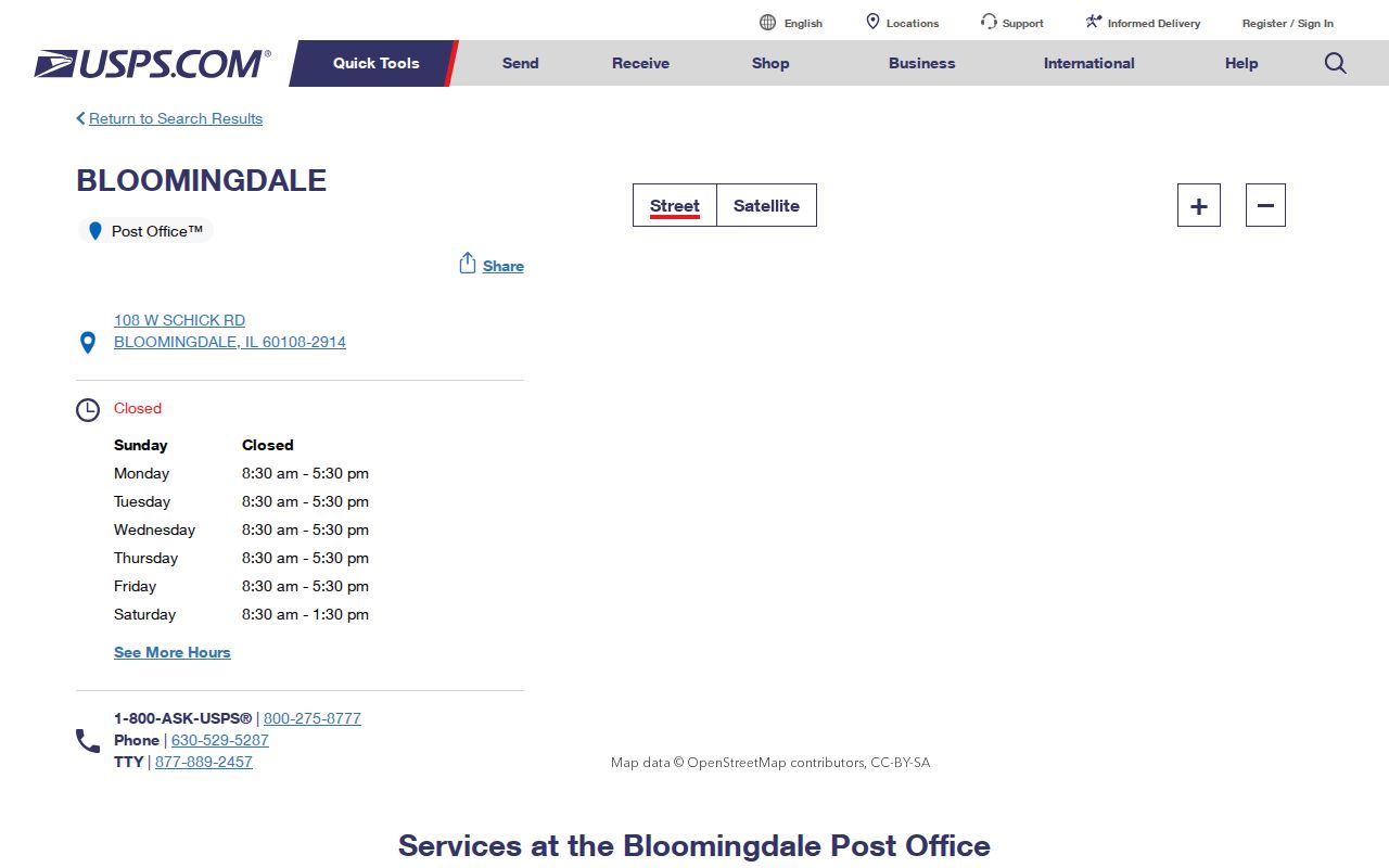
The facility listing anchors 60108 to a current official postal source rather than an inferred boundary.
Search Bloomingdale ZIP Codes at USPS
The USPS lookup has three jobs. “By Address” verifies one delivery address. “By City and State” returns ZIP codes recognized for a city. “Cities by ZIP” returns the preferred or recognized city names tied to one ZIP. Select the route that matches the question, and never treat the result as proof of a person's presence.
| USPS route | Required fields | Optional detail | Best use |
|---|---|---|---|
| By Address | Street, city, state | Company, unit, ZIP | Verify exact delivery format |
| By City and State | City, state | None documented | See ZIPs recognized for Bloomingdale |
| Cities by ZIP | ZIP | None documented | Check preferred and accepted city labels |
Add the unit when a building has many deliveries. If a result is unclear, try street plus city and state rather than starting with a guessed ZIP. Save the returned city spelling and ZIP+4 with the search date, since postal assignments can change.
A postal search that returns nothing still leaves useful checks. Confirm the street spelling in the Village address map, then compare it with the situs field in DuPage Property Lookup. Older records may use a township, neighboring post office, or former house number. Bloomingdale Public Library's dated map collection can bridge that gap. USPS remains the authority for the present delivery line, while the county and Village sources explain why an older form may differ. Keep both forms in the research log instead of replacing the historical address with a modern one.
Why Bloomingdale 60117 Is Different
Postal Bulletins from 2004 and 2005 used 60117-2208 and 60117-7000 for Great Lakes Area USPS or facilities-service addresses in Bloomingdale. Those dated examples establish an official operational use. They do not show that 60117 is a normal delivery ZIP for every Bloomingdale household. A current exact address must still be checked in USPS.
This distinction prevents a common ZIP code directory error: turning a valid institutional or unique-use row into a residential boundary. Keep 60117 labeled with its source date and purpose. If a current record shows it, compare the full address rather than changing the ZIP to 60108. If an old record shows it, preserve the historical value and seek a current postal result separately.
The source date matters as much as the five digits. The historic examples identify specific Bloomingdale facilities and ZIP+4 values, not a mapped service area. No current separate 60117 station page was found during research. A directory entry, deed, or government filing that uses 60117 should therefore be quoted as recorded and checked against the live USPS tool. That method respects the source without turning one operational address into a claim about every nearby parcel.
Key distinction. A valid Bloomingdale ZIP can describe an operational address without defining a neighborhood or proving residence.
Bloomingdale Postal and Parcel Fields
DuPage Property Lookup separates a parcel's situs, the physical property address, from its billing or mailing address. These can have different cities or ZIP codes. The portal also uses a ten-digit parcel identification number, or PIN. A PIN such as 10-07-107-003 may be entered without punctuation as 1007107003. It identifies county land, not a USPS delivery zone.
Compare four keys when records disagree: USPS street and ZIP, county situs, county billing address, and Village municipal status. Add the legal description or subdivision when annexation is involved. This avoids assigning the owner's mailing ZIP to the parcel or treating a postal city as proof that land sits inside Bloomingdale's incorporated border.
Note: Preserve both the situs and billing fields; changing one to match the other can erase the reason a record appears inconsistent.
Bloomingdale Annexations Shift Labels
Village and postal geography can move on different schedules. Bloomingdale ordinances document 2022 annexation actions for Glen Ellyn Road PIN and address clusters. A 2023 ordinance disconnected 132 and 136 Picton Road subject to Roselle annexation. The 2025 ordinance list includes Army Trail annexation and rezoning actions. These records explain why the same tract may keep a familiar postal label while its municipal status changes.
Review the Village history and growth record before interpreting the captured local geography.
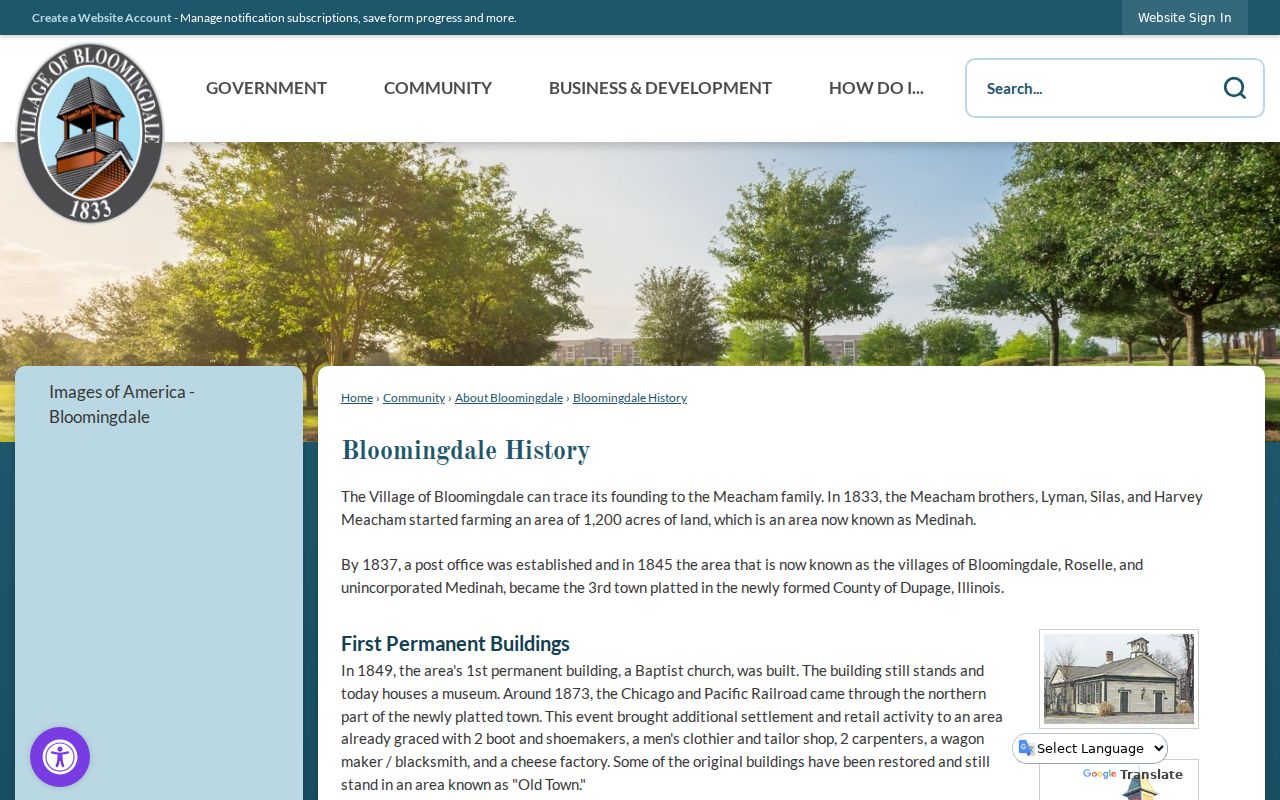
The chronology supplies local context, while a current USPS result and ordinance decide the postal and municipal questions. For a disputed tract, search the Village archive by address, PIN, owner, or project name, then compare its legal description with County GIS.
Access does not stop with online maps. Village administrative staff route municipal records and Illinois FOIA requests, including ordinances, plats, permits, and address-linked approvals. The DuPage Supervisor of Assessments can clarify parcel display fields, and GIS staff provide the spatial record. For an older municipal change, search the Village Archive by keyword and date, then request the exact file if the scan is missing. Each office answers a different part of the ZIP code directory question, so a postal mismatch may require more than one custodian.
Find Bloomingdale Residents by ZIP
None of the inspected DuPage resident-record portals exposes a broad ZIP filter. Property Lookup offers PIN, address, billing-name, and map routes. The voter form uses house number, street name, direction, suffix, and required city. GIS can select geographic parcels but did not expose an inspected ZIP field. A careful search verifies postal geography first, then moves address by address or through an official map selection.
- Enter the full street and unit in USPS By Address. Save the standardized city, ZIP, ZIP+4, and search date.
- Compare the result with DuPage Property Lookup's situs and billing fields. Save the PIN for a stable land key.
- Use County GIS or a Village address map to test whether the parcel sits within the intended municipal area.
- Run the DuPage voter address route with house number, bare street name, separate suffix, and Bloomingdale selected as city.
This method does not create a household list. It narrows official records to addresses whose postal and land geography has been checked. Once a ZIP narrows the area, the Bloomingdale street directory explains the full address-keyed record chain.
The DuPage voter search is useful after the postal step, not before it. Its address route requires house number, street name, and city, but it provides no ZIP field. Direction and suffix have their own controls, and the street box should omit both. A result can route the address to precinct, polling, district, or sample-ballot information. Public voter data has statutory redactions, so it cannot serve as a complete resident list. If the form fails, contact the Election Division at 421 N County Farm Road in Wheaton or call 630-407-5600 for help with the official address format and lawful record access.
The Grove Creates ZIP Records
The former Stratford Square Mall site is becoming The Grove at Bloomingdale. Village records from 2025 and 2026 include TIF documents, acquisition action, public hearings, and a plat of consolidation. Plans describe more than 280 residences and major openings anticipated in 2027. This is a timely example of parcel and address records changing before a settled directory trail exists.
Open Bloomingdale's current ordinance list before viewing its captured address-specific records.
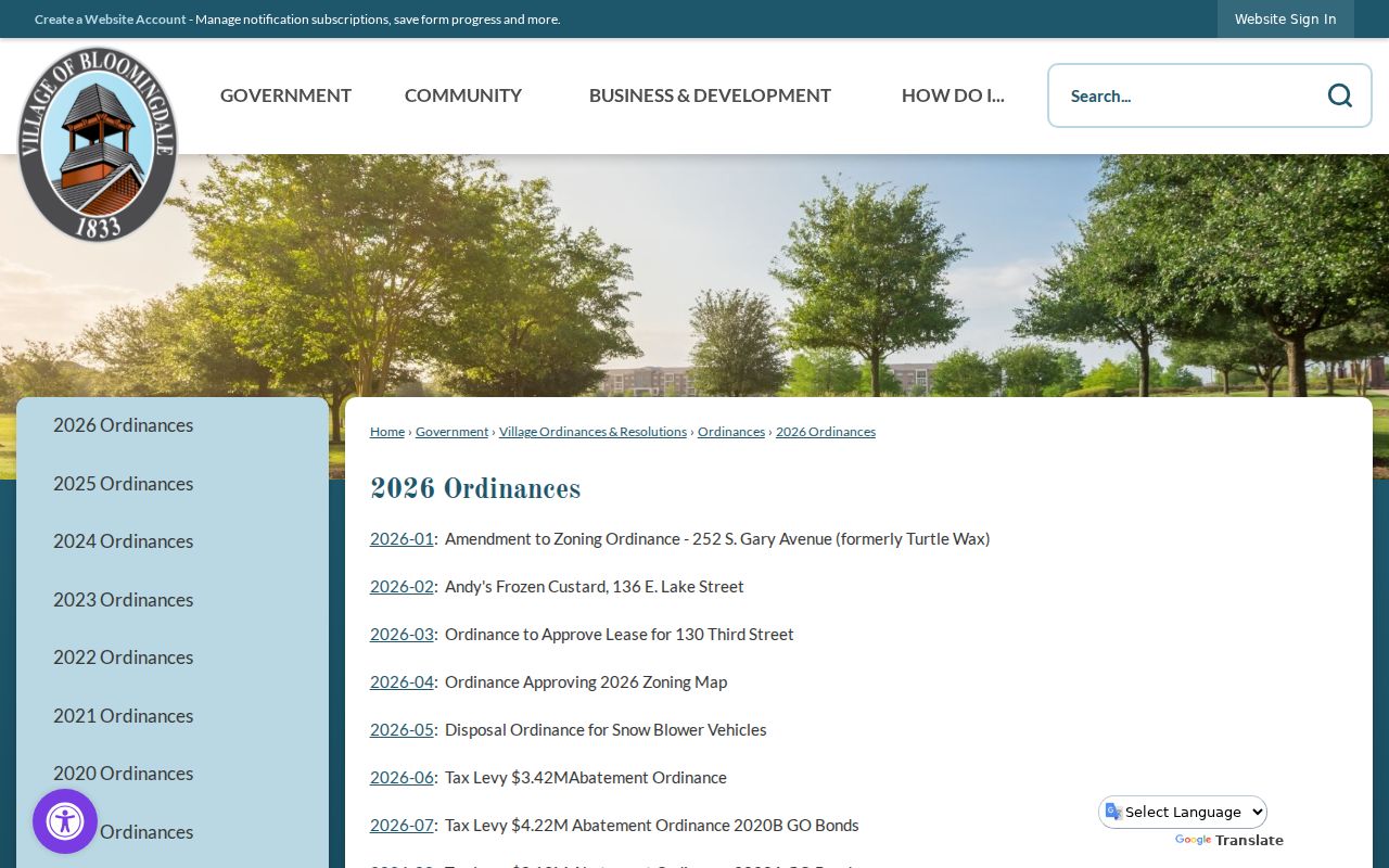
The ordinance list links municipal approvals to dates and document numbers, which can be paired with later USPS assignments.
Follow the official Grove project record for the project documents shown in the second capture.
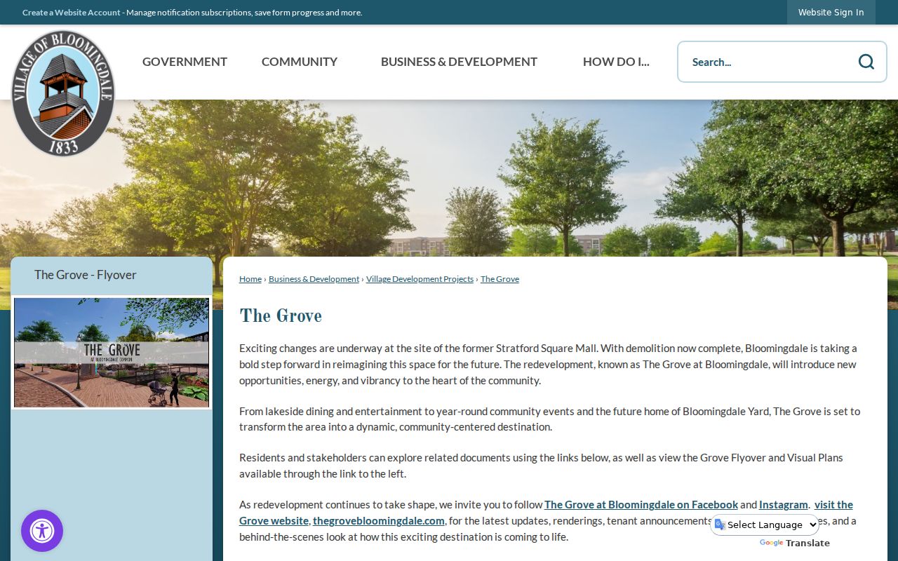
The project page provides the evolving place name; the plat, parcel PIN, and future USPS result will provide durable record keys.
The sequence is important. A plat of consolidation changes the land description, and later permits or ordinances may introduce building addresses. USPS delivery assignments can follow on another schedule. Save the project-page date, ordinance number, parcel PIN, plat reference, and first verified postal result. That bundle will let a later researcher distinguish former mall parcels from new lots and venues without assuming that every Grove document used the final mailing address.
Bloomingdale ZIP and Village Limits
A ZIP code is a delivery tool, not a municipal boundary. Bloomingdale's incorporated line, a DuPage parcel, a subdivision, a voting district, and a postal city can overlap without matching. Unincorporated or newly annexed land may retain a neighboring postal label. A Bloomingdale label can also appear on an operational address whose ZIP is not the ordinary local row. No official current address-level crosswalk was found, so each disputed address needs a USPS check, parcel PIN, Village map, and dated municipal source.
- ZIP vs ZIP+4
- The five-digit area is broad; four added digits narrow delivery to a segment, building, or box group.
- PO-box ZIP
- A ZIP used for post-office boxes rather than ordinary street delivery.
- Unique ZIP
- A ZIP assigned to one large organization or operation instead of a general neighborhood.
- Carrier route
- A postal delivery path within a ZIP, not a city or parcel boundary.
Historical research needs a date key. Bloomingdale Public Library holds a 1963 Village House Numbering System map, plus later address maps. It is evidence of an address-system bridge, but no ordinance naming specific renumbered streets was found. Compare old directories with dated maps and do not project a modern ZIP onto an older address without support.
Emergency-service geography is another separate layer. A Village archive notice records that enhanced 9-1-1 service was available countywide by September 11, 1991 and displayed the caller's telephone number and address to a dispatcher. That history helps date the local shift toward standardized emergency addressing, but it is not a public household directory or a current ZIP assignment policy. No public readdressing history or current E911 address-assignment list was located. For a new or changed address, begin with Village Building and Zoning or Engineering, use County GIS for the parcel, and finish with USPS for delivery.